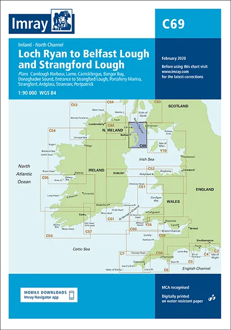
Description
Imray C69
Loch Ryan to Belfast Lough and Strangford Lough
Plans included:
Carnlough Harbour (sketch plan)
Larne (1:18 500)
Carrickfergus (1:15 000)
Bangor Bay (1:17 500)
Donaghadee Sound (1:25 000)
Entrance to Strangford Lough (1:37 500)
Portaferry Marina (1:7500)
Strangford (1:5000)
Ardglass (1:15 000)
Stranraer (1:12 500)
Portpatrick (1:6000)
On this 2018 edition the chart specification has been improved to show coloured light flashes. Depths have been updated from the latest surveys. The Marine Nature Reserve in Strangford Lough is included. There has been general updating throughout.
Part Number: YOT0743
Scale: 1:90000
ISBN: 9781786790620
Publisher: Imray Laurie Norie And Wilson Ltd
Manufacturer: Imray Laurie Norie And Wilson Ltd
Author: Imray
Edition: 2018
Printed and corrected to: February 2020
Format: Sheet size 787 x 1118mm. Waterproof. Folded in plastic wallet.
Explore more from our collection.
Reviews
There are no reviews yet.