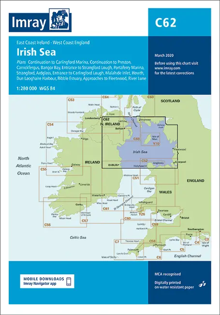
Description
Imray C62
Irish Sea
Scale: 1:280,000 WGS 84
Plans included:
Carrickfergus (1:15 000)
Bangor Bay (1:17 500)
Entrance to Strangford Lough (1:37 500)
Portaferry Marina (1:7500)
Strangford (1:5000)
Ardglass (1:15 000)
Entrance to Carlingford Lough (1:26 000)
Continuation to Carlingford Marina (1:40 000)
Malahide Inlet (1:35 000)
Howth (1:12 500)
Dun Laoghaire Harbour (1:15 000)
Ribble Estuary (1:125 000)
Continuation to Preston (1:125 000)
Approaches to Fleetwood (1:50 000)
River Lune (1:100 000)
On this 2014 edition the latest wind farm developments are shown off the coast of England and Wales. Changes to depths from recent surveys are included, particularly at Belfast Lough, Ardglass, Howth, Dun Laoghaire Harbour and the approaches to Morecombe Bay.
Explore more from our collection.
Reviews
There are no reviews yet.