Description
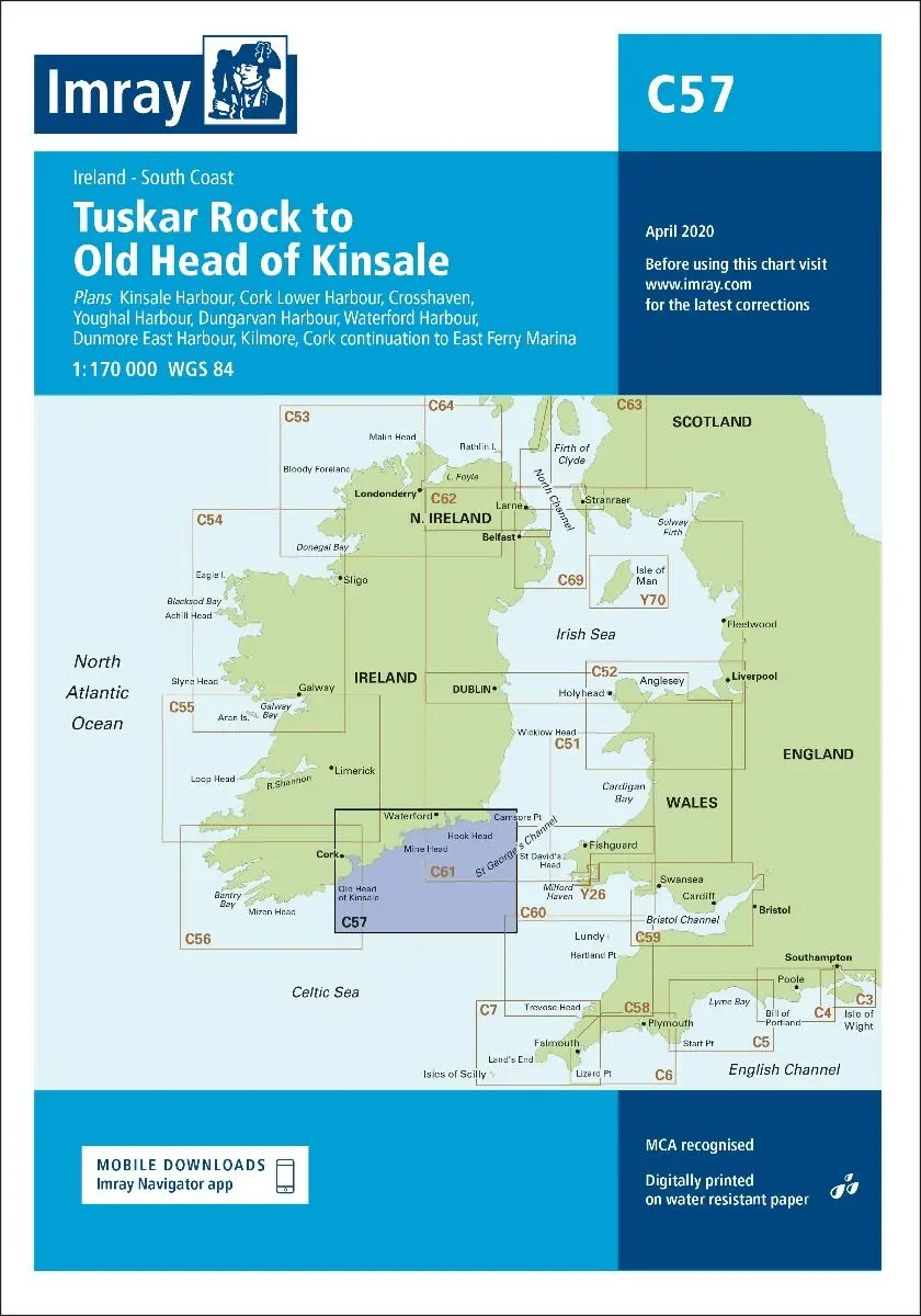
Imray C57
Tuskar Rock to Old Head of Kinsale
Scale: 1:170,000 WGS 84
Plans included:
- Kinsale Harbour (1:20 000)
- Cork Lower Harbour (1:35 000)
- Crosshaven (1:15 000)
- Youghal Harbour (1:25 000)
- Dungarvan Harbour (1:32 500)
- Waterford Harbour (1:55 000)
- Dunmore East Harbour (1:6000)
- Kilmore (1:25 000)
- Cork continuation to East Ferry Marina (1:35 000)
On this 2017 edition the latest depth surveys have been applied. The chart specification has been improved to show coloured light flashes. There has been general updating throughout.
Part Number: YOT0650
Scale: 1:170000
ISBN: 9781846238758
Publisher: Imray Laurie Norie And Wilson Ltd
Manufacturer: Imray Laurie Norie And Wilson Ltd
Author: Imray
Edition: 2017
Printed and corrected to: March 2021
Format: Sheet size 787 x 1118mm. Waterproof. Folded in plastic wallet.
Explore more from our collection.
Reviews
There are no reviews yet.