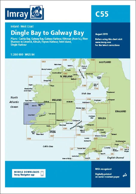
Description
Imray C55
Dingle Bay to Galway Bay
Plans included:
Cashla Bay (1:30 000)
Galway Bay (1:40 000)
Galway Harbour (1:15 000)
Kilronan (Aran Is.) (1:45 000)
River Shannon to Limerick (1:110 000)
Kilrush (1:30 000)
Foynes Harbour (1:17 500)
Fenit Island (1:35 000)
Dingle Harbour (1:25 000)
On this 2015 edition revised depths are shown throughout, in particular at Cashla Bay, Galway Bay, Kilronan, around Fenit Island and at Dingle Bay. Completed harbour developments at Kilronan are also shown.
Part Number: YOT0638
Scale: 1:200000
ISBN: 9781846236853
Publisher: Imray Laurie Norie And Wilson Ltd
Manufacturer: Imray Laurie Norie And Wilson Ltd
Author: Imray
Edition: 2015
Printed and corrected to: March 2021
Format: Sheet size 787 x 1118mm. Waterproof. Folded in plastic wallet.
Explore more from our collection.
Reviews
There are no reviews yet.